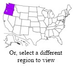
 A collection of metro fiber maps for the Pacific Northwest, specifically the states of Washington and Oregon. In other words, lots of fiber in the Seattle and Portland metro areas, and a bit in Spokane.
| Name | Maps | Lit/Dark | Comments |
|---|---|---|---|
| Spectrum Enterprise | Oregon/Washington | lit | PDFs |
| CSS Communications | seeking new map | both | |
| Fatbeam | Spokane, Tacoma, Centralia, Cowiche, Sunnyside, Medical Lake, Walla Walla, Yakima | both | |
| Level 3 Communications | Seattle, Portland, Eugene | both | Google Maps, zoom in |
| Unite Private Networks | Puyallup WA | dark | |
| Wave Broadband | Washington, Oregon | both | |
| Zayo Bandwidth | Seattle, Spokane, Wenatchee, Portland, Eugene, The Dalles, La Grande | both | |
| Still seeking maps for the following known providers: | |||
| Cogent | Seattle | lit | on-net buildings tool |
| LS Networks | Regional assets | lit | |
| XO Communications | Seattle, Portland, Spokane | both | |
Where possible, all links are to material offered on the websites of the company operating the fiber. I prefer such links, but will sometimes host the files myself where the operator agrees, and in rare cases may point to third party sources. Where available, links to on-net building lists are also given.
Additional maps of metro fiber networks that ought to be on this list are very welcome, as are corrections to the above links. Please just leave a comment below or send an email to info@telecomramblings.com.


Do these maps indicate the carriers own the entire fiber cable sheath? Owns an IRU? Buying capacity over someone’s sheath or IRU?
Too many carriers with virtual capacity or IRU “networks” …
Maps don’t show such things of course, one would have to research each network independently, and I’m sure the answer varies by loop rather than just by company. This is more of a ‘places to look’ list than anything definitive.
I will be adding a column for ‘lit/dark’ services, however.
Rob, the lead-in on the Pacific Northwest link (Oregon and Washington) refers to the New York Metropolitan area.
Huge undertaking, but much appreciated.
Thanks, all fixed now!
Rob,
Before I retired from Syringa Networks I sent you a picture you used for a while on this web site showing telco equipment near Grand Teton.
This is a link to the fiber map showing what Syringa Networks has in Idaho. You might want to add this to your Northwest collection
http://www.syringanetworks.net/OurNetworks/NetworkMap.htmlmn
Link correction. url to syringanetworks fiber map in Idaho is http://www.syringanetworks.net/OurNetworks/NetworkMap.html
It seems the URL changed again:
http://www.syringanetworks.net/resources/our_network/network_map/
Rob,
In order to work, the link for Black Rock Cable’s Google Earth maps may need to read:
http://www.blackrockcable.com/service.html
Thanks for the information.
LS Networks map is available at https://www.lsnetworks.net/about/network
When it comes to it fiber optics is all around the people in eastern Washington and when it passes right by you and there’s no way they would hookup any small people well when can we get a real map of what’s out there. Fiber was run over Stevens pass in the 80tys big line because i worked on equipment on that job so Spokane has more fiber then there saying.
What gis web page at Tacoma WA city shows downtown fiber routes?