


 A collection of metro fiber maps for networks within the state of California. There was a temptation to break this one up into northern and southern portions, given the size of the state. But as it turns out there are fewer independent metro fiber providers in California than I thought – especially those with public maps. If the situation warrants, I could split it up later.
| Name | Maps | Lit/dark | Comments |
|---|---|---|---|
| Atlantic Metro | Los Angeles | both | On-net list |
| Charter Business | Los Angeles, Bakersfield, San Luis Obispo, Santa Cruz, San Francsico, Modesto, Redding, Crescent City | lit | |
| Crown Castle | Los Angeles, San Francisco, San Diego, Bakersfield, Sacramento, Fresno | both | |
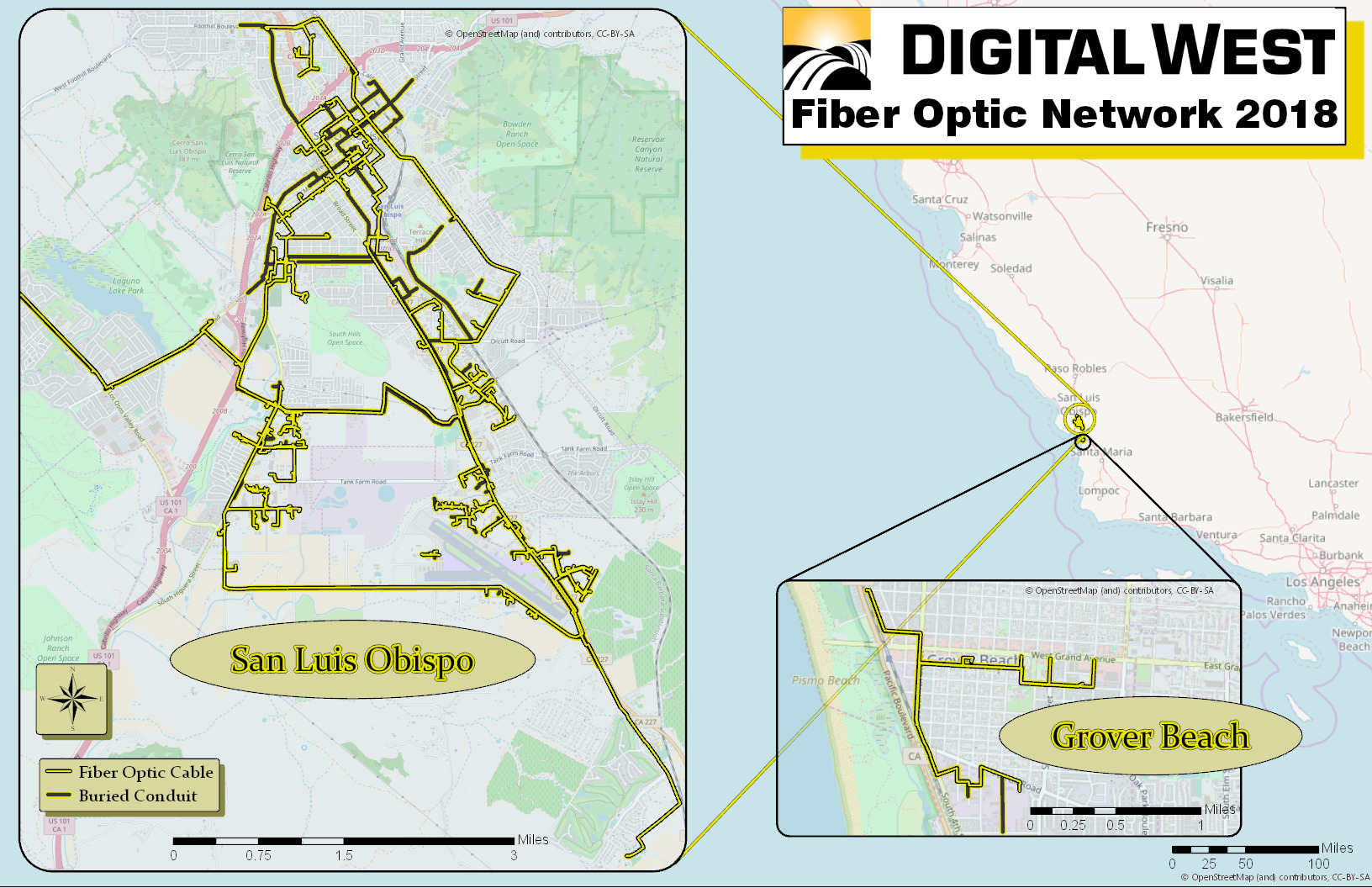
| Digital West | San Luis Obispo | lit | |
| Edison Carrier Solutions | Los Angeles Metro Area | both | |
| Level 3 | SF Bay Area, Los Angeles/Orange County San Diego, Sacramento, Fresno, San Luis Obispo | both | Google Maps interface, zoom in |
| Wave Broadband | Bay Area | both | |
| Zayo | Los Angeles, San Diego, San Francisco, San Jose | both | |
| Still seeking maps for the following known providers: | |||
| AT&T | both | ||
| Cogent | lit | On-net buildings tool | |
| Point to Point Inc | dark | ||
| Telepacific | lit | via MPower, former ICG assets in CA | |
| TW Telecom | both | ||
| XO Communications | both | ||
Where possible, all links are to material offered on the websites of the company operating the fiber. I prefer such links, but will sometimes host the files myself where the operator agrees, and in rare cases may point to third party sources. Where available, links to on-net building lists are also given.
Additional maps of metro fiber networks that ought to be on this list are very welcome, as are corrections to the above links. Please just leave a comment below or send an email to info@telecomramblings.com.
Wilcon link now fixed
This is a great idea and a good start to share information. We are a VNO and post our on net list at http://www.intelletrace.com/OnNet-Bulding-Search.html. Check it out.
Marc
We’re looking for an alternative carrier to the ILEC who can provide fiber services to 7800 n figueroa st LA 90012
Check out the most comprehensive on-net building search available – http://www.litbuilding.us
Looking for On Net Locations and which carriers are present? Over 1 million on net locations and 45 carriers represented
Visit http://www.onnetbuildings.com and take a 7 day free trial